

Unpacking content from Bali Business Review on YouTube, this report contrasts Bali’s accelerating built environment with the island’s remaining natural landscapes. Drone-captured scenes illustrate how development corridors, new construction and changing land use intersect with beaches, rice terraces and coastal ecosystems, raising questions about long-term economic sustainability and property performance.
Drone Perspective: Visualizing the Tension Between Development and Nature
High-altitude and close-range aerial imagery provides a single, continuous perspective that makes contrasts stark: newly developed clusters and infrastructure corridors sit adjacent to preserved rice paddies, coastal fringes and forest patches. These visuals reveal patterns of sprawl, infill and conversion that are difficult to perceive from ground level, highlighting where growth is concentrated and where ecological edges are being fragmented.
Details to note from the footage
- Clusters of new construction near main roads and tourist hubs suggest land value arbitrage and developer focus.
- Encroachment on rice terraces and small wetlands indicates potential long-term risk to local water systems.
- Visible gaps between developed parcels point to opportunities for strategic infill or conservation corridors.
Jason, Business Journalist at Bukit Vista
You’re a property owner? Wondering What Could Your Bali Villa Really Earn?
Get a data-driven revenue projection based on your property type, area, and bedroom count. Discover your villa’s true earning potential in Bali.
Property Performance: Are Bali Villas and Rentals Underperforming?
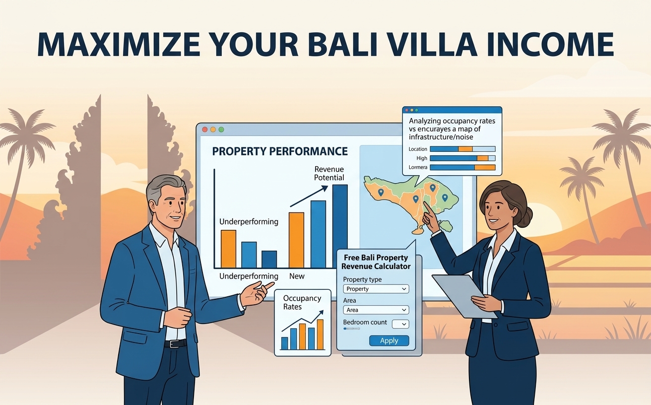
The aerial contrast prompts a deeper economic question: are certain properties failing to capture their full revenue potential because of location, environmental degradation, or mismatched market positioning? Visual proximity to noise-generating infrastructure or ongoing construction can depress short-term demand and create reputational drag for hospitality listings.
Owners and managers should treat the footage as market intelligence—cross-referencing aerial context with occupancy data, average daily rates and guest feedback to determine whether underperformance is structural or temporary. To assist owners with this analysis, a free Bali Property Revenue Calculator is available to estimate realistic earnings by property type, area and bedroom count: https://www.bukitvista.com/bali-villa-management?utm_source=BBR&utm_medium=video&utm_campaign=revcalc.
Policy, Planning and Sustainable Investment Responses
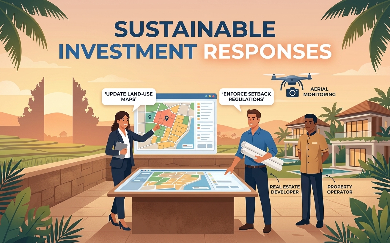
The imagery underscores the urgency for coordinated planning: zoning clarity, infrastructure sequencing, and incentives for conservation-minded development can reduce conflict between growth and natural capital. Municipalities and regional planners can leverage aerial evidence to update land-use maps, prioritize ecosystem protection, and enforce setback or buffer regulations that maintain the island’s scenic and ecological value.
Action items for stakeholders
- Local authorities: integrate aerial monitoring into permitting and zoning reviews to prevent incremental sprawl.
- Developers: adopt phased builds with environmental impact mitigation and community engagement plans.
- Operators: invest in property upgrades that protect natural amenities and communicate those advantages transparently to guests.
Key Takeaways
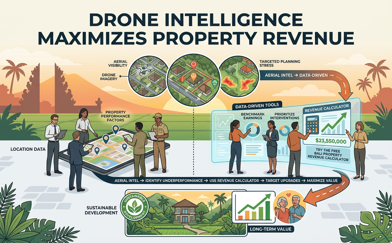
- Drone imagery makes development patterns and environmental stress visible, enabling targeted planning and investment decisions.
- Location-related factors seen from the air can materially affect property performance; owners should assess context against revenue data.
- Using data-driven tools like the Bukit Vista revenue calculator helps owners benchmark earnings and prioritize interventions: https://www.bukitvista.com/bali-villa-management?utm_source=BBR&utm_medium=video&utm_campaign=revcalc.
- Sustainable development and conservation-aligned properties are likely to maintain long-term value and guest demand.
Final word: Bali’s economic future depends on balancing growth with the preservation of the island’s natural assets. For property owners and investors, the business imperative is clear—use aerial intelligence and revenue benchmarking to identify underperformance, target upgrades, and align investments with long-term market preferences. To get a data-driven revenue projection for your property, try the free Bali Property Revenue Calculator here.